Statistics NEW in 2.0
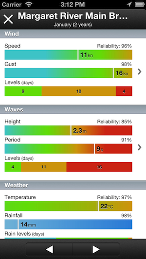
Monthly average data charts for wind speed, wind gust, waves height, waves period, and the number of days per month for each wind and waves alert level.
Wind rose NEW in 2.0
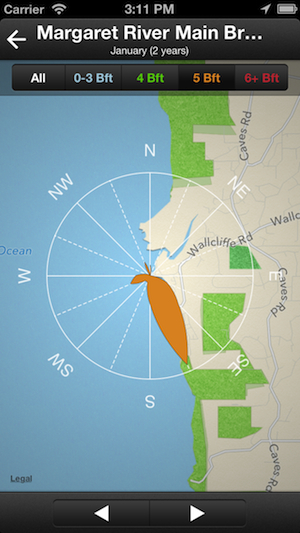
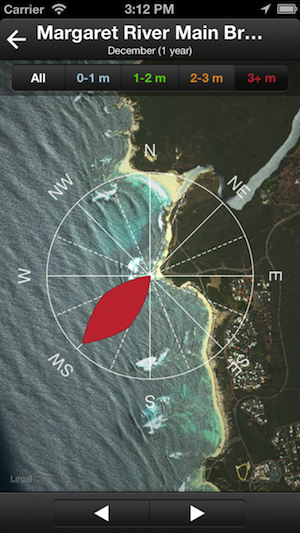
Wind and swell roses are available for all consolidated alert levels, and also for each individual alert level.
Swell rose NEW in 2.0
Map mode can be changed to satellite to better understand how the spot works for all directions.
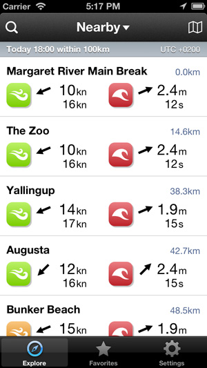
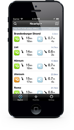
Nearby spots
Spots are sorted by distance from user location. By default, conditions are displayed for current user time.
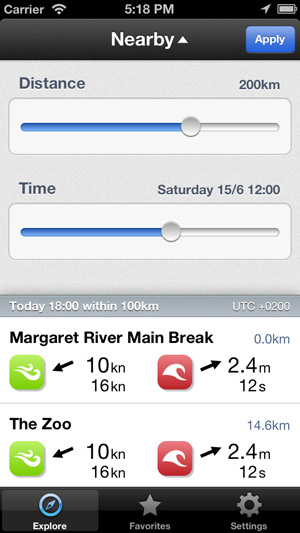
Spots filters
Time filter is useful to compare conditions between nearby or favorite spots at your next session time. Nearby spots also support a distance filter.
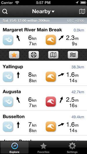
Spots options
Swiping a spot cell in any spot list will display all spot options like: Add or remove from Favorites, Radar, Map or Tide.
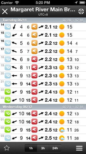
Forecast 1h
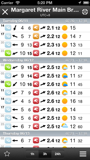
Spots forecasts feature wind data (direction, average and gust), wave data (direction, height and period) and weather data (temperature, clouds and rainfall). By default, time interval is 1 hour.
Forecast 3h
Spots forecasts feature three time interval modes: 1 hour, 3 hours or 24 hours mode. Default interval mode can be defined in app settings. It is also posible to enable/disable nighttime data.
Forecast 24h
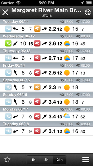
The useful 24 hours interval mode displays daylight highest wind and waves conditions, and the time that they will occur. This allows to quickly check the 8 days forecast.
Forecast chart
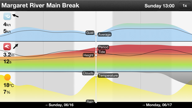
Features a 10 minutes data resolution, and integrates with wind, wave and weather charts a nice tide chart, if tide available. Three zoom levels are available: 0.5x, 1x (default) and 2x.
Search
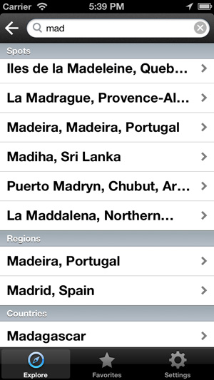
Search will suggest spots, regions or countries while typing. If no matches are found, then search will be performed based on the typed location.
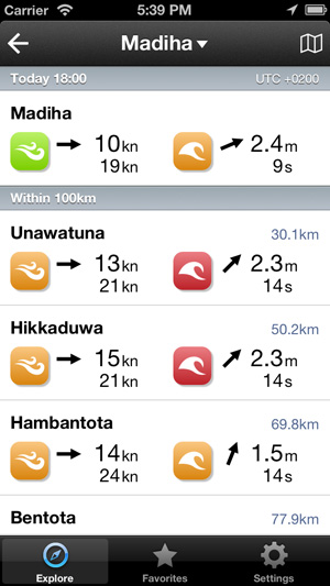
Spot results
When a spot is selected among suggestions, its forecast will be displayed together with nearby spots forecasts, sorted by distance. Distance and time filters are available.
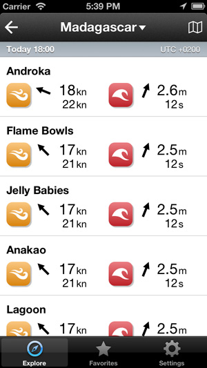
Country results
When selecting a country, spots will be sorted by conditions. As time filter is also available, it's amazingly easy to check strongest conditions in a whole country, region, or at any location, at any time in the following 8 days.
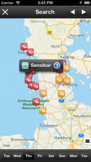
Spots list map
All spots in any list can be also viewed on a map. Wind and wave alert levels shown at each spot location represent daily strongest conditions.
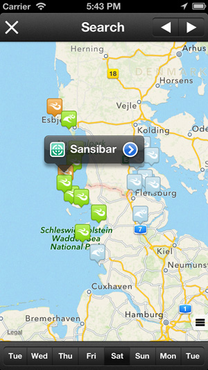
Forecast map
Browsing alert levels by weekdays makes really easy to understand how the forecast will evolve in a certain area.
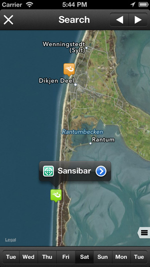
Map modes
Maps support standard, satellite and hybrid modes. Enabling satellite mode and zooming will display interesting geographical details.
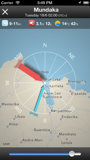
Forecast radar
This tools will help you to quickly check wind and swell directions in relation to the coastline shape, per hours, for the whole 8 days forecast. This will be your favorite tool if you are looking for specific orientations.
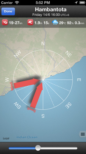
Sideshore layout
Big swell with perfect sideshore strong winds... Next friday at 16h will be an epic day!
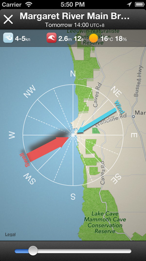
Offshore layout
Big swell with offshore light winds at Margaret River... Tomorrow at 14h will be the day for surfing!
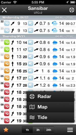
Spot menu
From the forecast details view, the spot menu will guide you to other spot options like Radar, Map and Tide. Soon more great features.
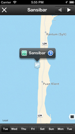
Spot map
Browsing the spot map can help you to discover nearby spots that may be matching better with current forecasts.
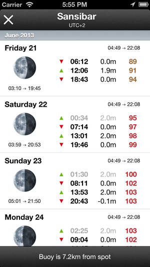
Spot tide
Tide data features daylight times, moonrise times, moonfases, high and low tide times, tide heights, and tidal coefficients for each tide.


